
Trace a Shawnee Street Record
Street-by-street research in Shawnee should move from the address to its stable parcel and legal-description keys. Begin with a normal street number, directional prefix or suffix, street type, and unit notation. Check the county tax search for the owner, property address, parcel number, and legal location. Then use the City Property layer to see the parcel geometry and nearby lot context. The deed index can carry the trail backward through recorded parties, while a directory or newspaper can supply a dated historical lead.
The sequence matters. A short search by street name alone can return many parcels, and a tax mailing address may not match the address on the ground. Keep the original user-supplied form alongside a USPS-standardized form. If a parcel is missing, try an address range, intersection, historical spelling, or legal description before deciding that the location has no record.
- Normalize the Shawnee address, including directional words, street type, and any unit number.
- Search the tax portal by address, street, owner, or parcel key to find the property trail.
- Open the City_Property map layer and verify the parcel against lots, plats, roads, and CityLimits.
- Search the County Clerk index for deeds by party, date, book and page, or legal description.
- Use dated directories or newspaper microfilm only when the goal is a past household or street history.
Normalize Shawnee Street Addresses
Street numbers are not enough. USPS's By Address tool accepts a required street address, city, and state, with optional company, apartment or suite, and ZIP fields. The AIS Viewer can add ZIP, ZIP+4, carrier route, county, delivery point, and check digit. Those services check address quality. They do not confirm who receives mail there. Preserve both the postal form and the original wording because a standard form can hide an omitted unit or an older street form.
Shawnee records may also use a subdivision, block, lot, section, township, range, parcel ID, or intersection. Those keys are useful when an old directory has no modern ZIP or a street number does not map cleanly. The street directory is strongest when each spelling and number is tied to a date, not when separate address types are collapsed into one current-place claim.
- Parcel
- A mapped piece of property with a county or city identifier.
- Situs address
- The physical property location used by the assessor or GIS, distinct from a tax mailing address.
- Plat
- A recorded map that shows lots, blocks, streets, and subdivision layout.
- Criss-cross directory
- A historical directory arranged by address, often used to find a past household.
Search Shawnee Tax Fields by Street
The Pottawatomie tax-information search makes the street directory's address angle concrete. Its visible fields include Owner Name, Address, Street Name, Treasurer's Parcel Number from a tax statement, CAMA or Appraiser's Parcel Number, and Section, Township, and Range controls. Entering the beginning of a street name or address can be useful where an exact number is unknown. The form did not expose a ZIP field, so a ZIP-wide roster is not a function of this search.
The official tax search shows the address and parcel routes available for Shawnee street research.
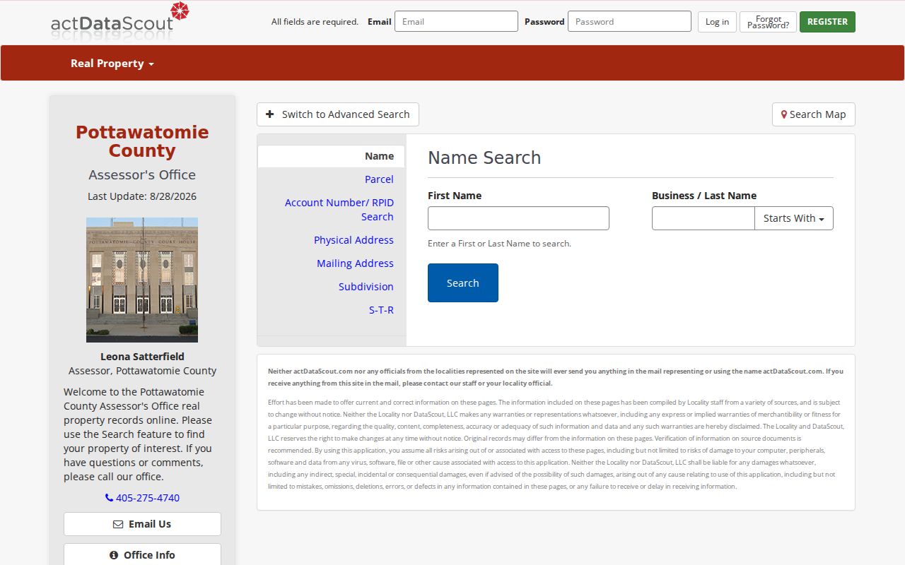
Tax ownership is not occupancy. The owner can be a trust, estate, company, or person receiving notices elsewhere. Pottawatomie County's 2026 assessor notice also says taxpayers are responsible for keeping mailing addresses current. A returned or changed mailing address is not proof that someone lives at, or has left, the Shawnee parcel.
Map Shawnee Streets With City GIS
The City of Shawnee City_Property service has Property, Buildings, Parcels, and a City_Property layer. Layer 47 is a polygon feature layer with Parcel_ID, owner, Property Address, Documents, Description, Additional Notes, and creation or edit fields. It supports identify and query operations, plus distance, statistics, pagination, order-by, and SQL options. Its 2,000-feature maximum means a broad street query may need a narrower clause or pagination.
The public Shawnee GIS property service lists the map layers used for a street-directory search.
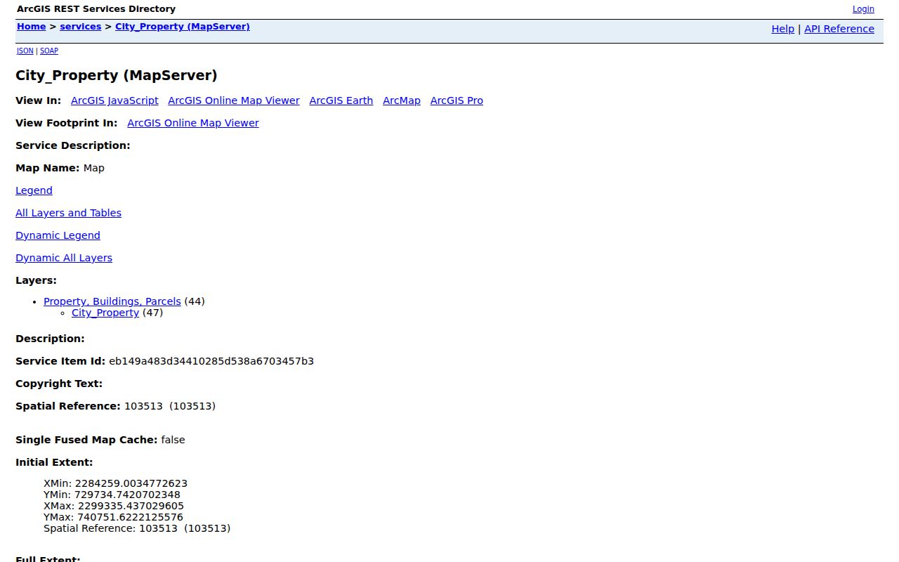
Save the query details when the result matters: the address or Parcel_ID, where clause, outFields, spatial relationship, distance, and access date. For a street at the edge of Shawnee, compare CityLimits and Roads before treating a postal street label as proof of municipal location. Lots, Plats, and Blocks help reconcile map geometry with the legal description in a deed.
Match Shawnee Streets to Records
Every address-keyed system answers a narrower question. The coverage table separates present parcel information from transfer history and dated project records. Use the record that fits the date and type of evidence needed. The full person-by-person verification approach is reserved for the Shawnee resident lookup route rather than a street-wide scan.
| Street evidence | Shawnee keeper | Address connection | Access |
|---|---|---|---|
| Tax and parcel search | Assessor/Treasurer | Owner, property address, parcel, legal-location lead | Public search |
| City_Property GIS | City of Shawnee GIS | Parcel geometry, property address, owner field, map context | Public map/REST service |
| Recorded instruments | Pottawatomie County Clerk | Parties, instrument, date, legal description, book/page | Index and clerk routes |
| Building permits | City of Shawnee | Project address and applicant, owner, or contractor role | Permit channel or request |
| Directories and newspapers | OHS and library collections | Dated historical address or social notice | Research Center or microfilm |
Use a public voter record only through its stated verification or request channel. The ordinary public-file descriptions do not promise a browse-by-street portal, and protected voters must not be inferred from nearby address data.
Follow Shawnee Deeds Along a Street
Recorded land research begins with the current parcel's legal description or Parcel_ID. In OKCountyRecords, visible search controls include name, party type, book, page, series, instrument number, instrument type, recorded start and end dates, legal description, addition, block, and lot. The county says its online index and images begin in January 1985. The County Clerk links Kofile QuickLink and the clerk counter for earlier plats and land records.
For a transfer trail, find the current owner as grantee, read the purchase instrument, then search the seller as an earlier grantee while keeping the legal description aligned. A deed party can be a trustee, executor, lender, agent, or releasee. Treat the party role and instrument type as evidence, not as proof of who lived on the street. The county's free land-record alert tool can monitor a searched name and legal description for later instruments.
Note: The January 1985 online boundary is an index limitation, while the County Clerk says local recordings reach the late 1800s.
Use Shawnee Permit Address Clues
Shawnee's CitizenServe permit categories include commercial and residential building, sign, floodplain development, land disturbance, plan review, public improvement, and right-of-way work. The city's residential permit materials include a physical address or intersection, project name, legal-location fields, owner or applicant, mailing information, contractor roles, work description, and permit number or date. Those fields make a permit a dated project record, not a household roster.
City materials describe general digital permit information back to 1997 and paper archives back to 2005. The application says review begins after receipt, work cannot start before issuance, and inspections follow a separate process. Search an exact address and date range through the permit channel or make a defined city request. Do not assign a contractor, designer, or applicant's address to the property without evidence of that role.
Compare Shawnee ZIP and City Limits
For Shawnee, 74801, 74802, and 74804 are official search candidates, but they are postal labels, not parcel boundaries. A ZIP can cross municipal or county lines, and a Shawnee postal city can include addresses outside the incorporated city. Census ZCTAs are generalized areas built from addresses, not delivery-route polygons. Check the exact address in USPS and then use CityLimits or parcel geometry for the municipal question.
ZIP+4, carrier route, and delivery-point details can make an address form more precise, yet they still do not identify a person. The Shawnee ZIP directory keeps this postal geography separate from the street-by-street parcel process.
Find Historic Shawnee Street Evidence
When the goal is a former household, move to a dated source rather than applying a current map backward in time. OHS documents a 1901 Shawnee directory and Polk's Shawnee directories from 1909 through 1952, with later references. The Shawnee News-Star collection has a visible digital run from 1957 through 1962, and Shawnee Public Library offers microfilm access with librarian assistance. Keep the issue date, directory year, address wording, and page or volume reference together.
Railroad-era labels can help focus a search. Shawnee's 1891 land run, 1895 railroad arrival, 1896 divisional shops, and 1903-04 Santa Fe Depot are useful date and place anchors. They do not license a modern street-number substitution. When street wording changes, bridge records through legal description, lot and block, nearby cross streets, and successive directory forms.
Respect Shawnee Street Directory Limits
The Shawnee street directory can identify public parcel and address evidence, but it cannot reveal every household member. City GIS does not list renters, utility customers, or delivery recipients. Driver records are restricted under the Driver's Privacy Protection Act. Ordinary voter data has confidentiality limits, and Address Confidentiality Program participants and restricted voters have protected addresses. A street-level record should never be used to reconstruct a protected location.
For a legitimate record question that a portal cannot answer, ask the named custodian for an existing record, a specific date range, and the record type. The Oklahoma Open Records Act permits reasonable procedures and lawful redactions. It does not require an agency to build a new list of residents from separate files.