
Previous Residents of a Shawnee Address
The trail for previous residents is an era-by-era research job. County records identify transfers and legal descriptions. Historical directories and newspapers can supply dated address-to-name leads. Census schedules provide a household snapshot on an enumeration date, not a current record. Construction and map sources can show when a building or lot configuration changed. Start with the time period you need, then use a source that actually covers it.
| Source | Years it covers | Where held | What it can show |
|---|---|---|---|
| County Clerk online index and images | January 1985-present, with real-time additions stated | OKCountyRecords | Recorded parties, instrument type, date, book or page, legal description, and images subject to portal access. |
| County Clerk historical books and plat route | Late 1800s-1984; exact online runs not fully exposed | Clerk, Kofile QuickLink, OHS, or library research | Earlier deeds, plats, mortgages, liens, and legal descriptions. |
| Shawnee city directories | 1901; Polk years 1909-1952 and later 1988 and 1992-95 references | OHS and partner collections | Dated address, name, and year-to-year continuity clues. |
| Sanborn maps | 1929-July 1950 | Library of Congress | Building footprint, use, block, and street context, not a resident list. |
| Federal census | Released under the National Archives 72-year rule | NARA, FamilySearch, and library databases | Household and relationship snapshot on the enumeration date. |
| City permit archives | General digital information back to 1997; paper files back to 2005 | Shawnee Planning and CitizenServe | Construction, alteration, owner or applicant, contractor, and inspection timing. |
Ownership and residence are different findings. A parcel may be held by an estate, trust, company, or an owner whose mailing address is elsewhere. Record a deed party as a deed party. Use a dated directory, census, newspaper, or other lawful historical source before describing a person as part of the household.
Shawnee Previous Residents and Deeds After 1985
The Pottawatomie County OKCountyRecords search is the online deed route for records indexed from January 1985 forward. Its captured fields include name, party type, book and page, series or instrument, recording date range, legal description, addition, block, and lot. Name can be entered as last name, first name or as a business. Party type is optional, and its exact choices did not render during the research capture, so verify the live options before relying on a filter.
Use the legal description when a street number changes or a name is common. Search results and image access are not the same service. The research notes that print tokens or account services may apply to images, while the index helps identify the instrument. The county also offers free land-record monitoring by searching a name or legal description, selecting the blue Monitor control, creating an account, and choosing email frequency. That alert is a property-fraud and ownership-change tool, not a way to identify a household.
The County Clerk land-record search source shown here documents the fields available for tracing a Shawnee deed chain.
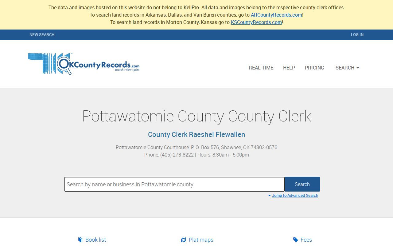
A date window plus party role and legal-description fields makes it possible to narrow a transfer trail without assuming that every name attached to an instrument was an occupant.
Note: The stated 1985 boundary is an online-index limit, not the first year Pottawatomie County kept land records.
Shawnee Previous Residents Before 1985
The County Clerk says local recording reaches the late 1800s, while the online index and images begin in January 1985. When a backwards chain reaches that boundary, use the county's linked Kofile QuickLink route for prior plats and land records, ask at the Clerk counter, or work through historical index books, microfilm, OHS, and library assistance. The selected Pottawatomie interface and its image fees were not exposed in the research, so confirm the current field set and access terms before a visit.
Keep the cutoff in your notes. A chain that stops at an online portal may continue in a book, plat, or counter index. The Pottawatomie County Clerk is at 309 N Broadway Ave. in Shawnee and records deeds, mortgages, liens, oil and gas leases, plats, military discharges, and related county records. A historical request works best when it gives the legal description, approximate recording period, and instrument type rather than just a modern street address.
- Grantor
- The party transferring an interest in a recorded instrument. A grantor is not automatically a prior resident.
- Grantee
- The party receiving an interest. Search a seller as a prior grantee to locate that person's earlier acquisition.
- Chain of title
- A sequence of recorded transfers tied together by the same parcel or legal description.
- Legal description
- The lot, block, addition, section, township, range, or other land description used to keep the same property identifiable when street wording changes.
Shawnee Address Crosswalk Across Time
Historical address forms should not be overwritten with a current mailing form. The research recommends a record-era crosswalk: a 1901 or 1909 directory spelling, newspaper street wording, modern USPS form, City GIS Parcel_ID, and County Clerk legal description. Each belongs in a separate column with its own date. That preserves the evidence when an old suffix, a missing unit, or a changed number makes a straightforward address search fail.
Use Shawnee City_Property layer 47 to check a parcel by Property Address or Parcel_ID, then compare Lots, Plats, Blocks, Roads, CityLimits, and Zoning where needed. The layer supports query, pagination, distance, and spatial tools. It is a parcel and property-information layer, not a census of occupants. Its maximum record count is 2,000, so a broad street-wide query may need pagination or a narrower clause.
- Retain the address exactly as printed in the older source.
- Record a newspaper or directory date before trying a modern equivalent.
- Find the Parcel_ID or legal description through the parcel, tax, or deed source.
- Compare nearby cross streets, subdivision wording, and map context when the forms do not match.
- State the historical and modern forms separately if the match remains uncertain.
There is no verified Shawnee street-renaming or renumbering schedule in the captured research. Bridge a suspected change with legal description, subdivision, cross streets, railroad or depot landmarks, and successive directory wording rather than inventing a conversion.
Trace Past Owners in Pottawatomie Deeds
Start a backward deed chain with the current parcel's legal description or Parcel_ID, not only its street number. The County Treasurer tax search can supply owner, address, street, parcel, CAMA, and section-township-range leads. Its owner result may show a mailing address that is not the parcel's situs, so retain those values separately. Then locate the current owner's purchase deed in the County Clerk index with the owner as grantee and a reasonable date range.
- Find the current parcel and write down the legal description, parcel identifier, situs address, and mailing address as separate fields.
- Search the current owner as grantee in the County Clerk index and identify the purchase instrument.
- Record the seller or grantor, recording date, instrument or book and page, and the complete legal description.
- Search that seller as a prior grantee, then repeat while the parcel description remains continuous.
- When the online chain reaches 1985, move to Kofile, historical books, plats, microfilm, or a Clerk-assisted search.
Read the instrument type before assigning a role. A trustee, executor, lender, mortgagee, releasee, or agent may appear in a transfer trail without being the fee owner or a resident. Deed evidence is strongest when the same legal description, lot or block, and parcel continuity align from one record to the next.
Shawnee Previous Residents in Directories
Directories fill the household layer that deeds do not. The documented Shawnee runs include the 1901 Star Directory Company lead, Polk references from 1909 through 1952 with later 1988 and 1992-95 references, and broader OHS telephone-book, yearbook, and family-history collections. Search a surname and variations, check the classified material where relevant, compare nearby years, and record address and occupation separately. A directory address is historical evidence and must never be presented as a current residence.
The FamilySearch U.S. City and Business Directories collection offers name, occupation, and address fields across many American directories from about 1749 to 1990. It is an index route, not proof that a particular Shawnee volume or image is available. Confirm holdings and image access item by item. The historical volumes themselves are described in the Shawnee city directory collections.
The FamilySearch directory source below shows the kind of name and address access that can help locate a dated entry before checking the original collection.
Use a digital index as a lead, then keep the exact volume, date, page, and address wording from the underlying directory or image with the result.
Pair each directory year with an available federal census schedule. The census is a one-date household snapshot and a directory may have been compiled months before publication. Do not force them to agree when the dates differ.
Shawnee News-Star Trail Endpoints
The OHS Gateway Shawnee News-Star collection offers a newspaper layer for obituaries, legal notices, social columns, advertisements, and address clues. The title is listed as 1943-current, while the visible online material captured for research ran from 1957 through 1962. Search the OCR by surname, street variant, and date, then verify every match against the page image because names and street numbers are error-prone in OCR.
Sanborn maps provide a different kind of answer. The Library of Congress holds Shawnee maps dated 1929 through July 1950, comprising 91 images. They can show a building footprint, block, street, and use, but they do not name a household. City permit archives add a later construction layer: general digital building information goes back to 1997, while paper archives go back to 2005 according to city materials. No public utility-connection search was located, so do not fill that gap with assumptions.
Note: An obituary or a map can help close a dated research trail, but neither should be used to identify or track a living person.
Railroad and County-Seat Address Context
Shawnee's early records sit in overlapping geographic and institutional settings. A land run occurred in 1891, the Choctaw Oklahoma and Gulf Railroad arrived in 1895, divisional shops followed in 1896, and the Santa Fe Depot dates to 1903-04. The county-seat election took place on December 19, 1930, and the New Deal courthouse opened in 1935. These dates can narrow a search for public notices, plats, city records, or county records without turning a local-history event into a household claim.
Agency and tribal records can also be relevant to family history around Shawnee. OHS and FamilySearch describe Shawnee, Potawatomi, Kickapoo, and Sac and Fox agency record contexts. Keep agency residence, enrollment, payment-roll appearance, and citizenship distinct. Search the historical label and date used by the source, then compare it to a local address source before connecting it to a Shawnee property.
Past Households at a Shawnee Address
A reliable household timeline pairs sources that answer different questions. A deed chain can show a transfer. A city directory or census can identify a dated household lead. A newspaper may add an obituary or social notice. A Sanborn map or permit file can explain a building change. Store the source date and the address wording with each event. If the evidence conflicts, keep both records and describe the difference instead of selecting the one that fits a preferred story.
Shawnee Public Library provides microfilm assistance, and the Pottawatomie County Historical Society and Museum can provide local-history context. No official house-history guide was located in the research. Ask whether a particular address, subdivision, railroad block, or family collection is indexed before visiting. For a current address-keyed search, use the Shawnee street directory route rather than extending a historical inference into the present.